Bureau of Land Management Website
- TheFormidableGenealogist
- May 1, 2022
- 4 min read
Recently, our formidable Jen posted a great YouTube video about finding historic farm locations. A core step was using the Bureau of Land Management (BLM) website at https://glorecords.blm.gov/.
Established by Congress in 1785, the Public Land Survey System partitioned public lands into an orderly grid to assist with western expansion. The original thirteen colonies (plus Texas and other select areas) don't use this system. But if you're looking for land ownership in the remaining areas, the BLM site is the place to start. It contains a variety of documents pertaining to land patents, which is the term used for the transfer of land from the government to an individual. I use the BLM site frequently as my ancestral map is a constant movement westward, mostly during the 1800s, and my family tree is full of farmers.
An important point to note is that transfers of land between individuals are deeds. If your ancestor purchased land from another individual, that information would not be included on the BLM site. You'd need to consult county records.)
One of my favorite features on the BLM site is the Related Documents tab. Once you locate a tract of land, you can then view the patents from the rest of that section. That's helpful for a few reasons.
In this example, I am trying to find more about an ancestor named Daniel Nafziger. He's said to have been born in Germany around 1800 and to have lived in Ohio for a while, but I find no records from Ohio that concern him. The first reliable census record for him is in 1860. He died in Tazewell County, Illinois, and had also lived in nearby Woodford County, but there is nothing that indicates when he arrived in that state. Neither do I have documentation of his parents or any siblings. Perhaps there is a public land sale for him that could provide an anchor point on his chronological timeline and geographic map.
Daniel's surname has a number of spelling variations, and I've seen countless spellings that would be considered a mangling more than a variation. That's a limitation on the BLM site, which requires an exact spelling of a surname in order to return a result.
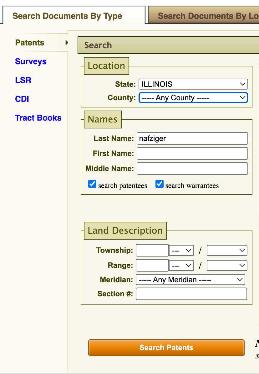
My first search in this instance can be fairly broad, as there can't be many patentees of that surname. I therefore only enter the state and the last name. The first variation of the surname that the site returned any results for is Nafziger.

There is only one result, for a Peter Nafziger in Tazewell County in 1856. That's the county where Daniel Nafziger died in 1886, so this entry looks promising.

Once I click on the link in the Accession column, I can see all the other patents in Township 26N, Range 3W, Section 4.

By seeing a list of all the patentees of that section, I can posit that the Christian Noffsler and Christian Nanfringer are probably variations of the surname Nafziger--and probably the same person. Christian was the earliest patent on the list with 1841, and Peter's was much later in 1856. Still, it's possible that Peter and Christian are related. One could assume it's likely that they are related somehow given the relatively unique surname. Could Daniel be related to Peter and Christian? Daniel is not on the list of patents from this section, but could he have patented land nearby?
I go back to the search function and search for a broader area: State of Illinois, Township 26N, Range 3W. The results from that search, shown below, now include a John Noffsler (1843) and John Nanfringen (1850). Surely another Nafziger purchaser. Still no Daniel, however.

I go back to the map for the earliest purchase, which was Christian in 1841 in Township 26N, Range 3W, Section 4. The snippet below shows the section of Christian's land bounded by the darker, smaller square. It's inside the lighter square, which represents the whole of Township 26N. As shown below, that section is in the northernmost tier of that township and range. That northernmost tier is also the border between Tazewell County and Woodford County. Daniel lived in Woodford County at the time of the 1860 federal census and 1865 state census. If I search one more township to the north, perhaps I'll find more Nafziger names.

Because the Public Land Survey System is so orderly, we know that the township directly north of Twp. 26N would be Twp. 27N. The range would be the same, as we don't want to move either west or east. So my next search is for State of Illinois, Township 27N, Range 3W.
The results of that search are below. Among those patenting land in Woodford County was Daniel Nofsinger. That would not have been a spelling I would have thought to search for directly, but I was able to find what turned out to be my Daniel Nafziger. I know know where he was in 1841. Also on this list are Peter Neftseah, Jacob Niftseah, and Christian Noffsler. Those three men, in addition to Daniel, are all Nafzigers whose German name was consistently spelled terribly by English speakers.

As shown below, Daniel's land is in the nothernmost tier of Woodford County That would make this tract 6 miles north of the tract shown for Peter, as townships are 6 miles wide by 6 miles tall. That's still close enough to the other Nafzigers to suggest that they have a connection beyond geographic. And in that way, finding an anchor point for Daniel should point to potential members of his family to research.

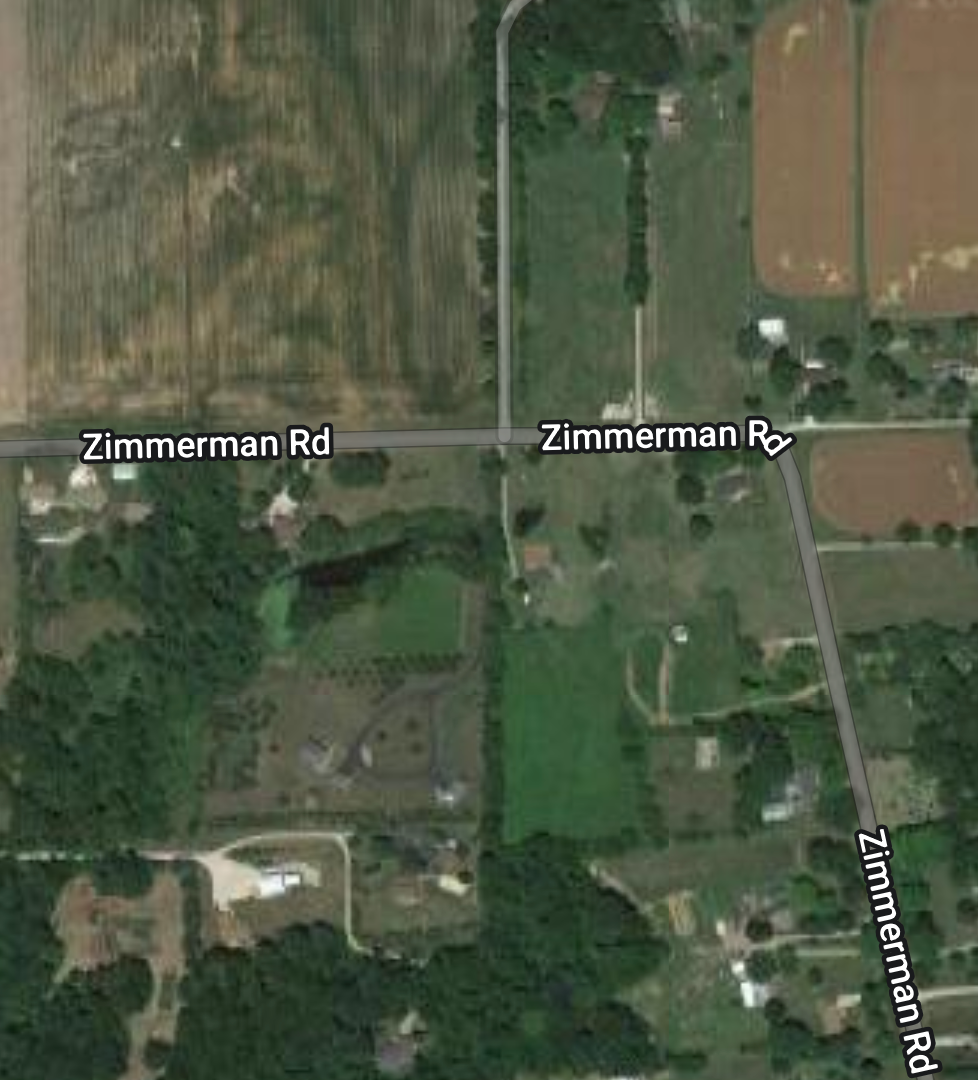
Comparing Daniel's land on the BLM map to a modern map, I can see that the area still looks agricultural. That's good to know, because the home of another ancestor from the same area is now under Interstate 474 in Peoria. That's an increasingly frequent resolution to questions that people have about historic farm locations. But I believe knowing the location is still important and can be very meaningful.

.png)


Comments